
Medialab-Prado Madrid. Digital Networks and Physical Space
Mais uma tarde no Medialab-Prado Madrid. O ambiente é excelente com pessoas realizando seus projetos em colaboração e com uma energia muito positiva. O evento hoje a tarde foi muito bom.
Não vou colocar links dos projetos para agilizar e voces podem encontrá-los em busca no Google.
A primeira apresentação sobre “Eversion and Locative Media” foi de Jeff Knowlton, o cara por trás do 34 North, 118 West, como já retratei em post e em últimos artigos sobre o tema. Ele mostrou projetos em Chinatown Los Angeles, onde usuários carregam tokens RFID e são mapeados nos seus percursos. Cada usuário, chamado de Symbiotes, aparece como um ponto azul no mapa e quando entram em relação, aparecem áreas verdes nos mapas. Knowlton apontou para a necessidade de artistas e urbanistas prestem atenção aos “territórios” e as novas “layers” do espaço urbano. Vemos aqui, visualmente, os territórios informacionais e a importância das novas camadas informacionais na definição dos lugares. Os mapas mostram o uso do espaço e a relação das pessoas redefinindo as funções dos espaço.
Na minha fala, “Locative media and informational territory” abordei questões teóricas sobre território, lugar, temporalidade, mobilidade, comunidade, a partir da discussão sobre territórios informacionais e mídias locativas. Mostrei algum projetos e o SUR-VIV-ALL. Insisti em questões centrais e de fundo. Alguns trechos da minha exposição:
TERRITORY
Territories are areas of control of borders. Borders are membranes and allow communication. Control and surveillance are forms of monitoring and tracking movements and flow within territories. With new locative media technologies, we must take into account not just the physical territorialities, but also the new forms of informational territoriality.It is not only a place of separation, but also a media, communication. Territories is “hubs,” areas of movement and flows. Social life produces space, places and territory. So it is not out of context to think that the information society creates new kind of territories. Informational territory reflects the new dimensions of territoriality, new relations of power and new social practices in contemporary society. What do we do when creating maps, when using a GPS with a mobile phone, when annotating electronically a space? Nothing but controlling the space, create a new sense of place, new forms of territorializations. But this is an endless process: territorializations claim for deterritorialization and so on…
PLACE
We must think that space is generic, formed by flow among places, that is formed by flow among territories. Place is an event create by flows within territories. For Tuan (1977) place is fixed borders, institutionalization, permanent control of an area in the generic space. The philosophical vision prevents us to see place only as a social fact. It is an essential dimension of human existence, a form of seizure the world, an “a priori” to Kant, an ontological need of man for Heidegger. We have “to build a dwell” to inhabit the world. Place is produced. Without that production, man does not exist. Is the essential need of a place that “produces” society, not the opposite.With the evolution of society in the industrial age, and the growth of movements and flow of goods, capital, people and information, the place cannot be seen only as a fixed portion of space, as an anchoring point of community. Place is an “event”, an intersection of flows dynamically produced in time.
Locative media do not point to a world of electronic cyberspace apart from the physical world. Instead, they insist in “augmented realities”, in playing on the street, in mapping and tagging real things. What we seeing now are several examples of integration, mixed processes that merge electronic and physical space, creating new forms and new senses of place, new order (territorialization) in urban space. So, informational flows creates informational territories within ordinary places like prison, school, hospital, offices, house, shoppings, etc. It is not the end, but emergence of new meaning of theses spaces. That vision goes against the thesis comes from thinkers like Tuan, Harvey, Meyrowitz, Virilio, Augé. The diagnosis here is that the places are dissolved into no places, that it lose it senses, and that speed and space and time compression are erasing places. We do not live without a place, but the place, since ever, must be seen as lines of escape, movements, appropriation and result of tactical uses. We are facing new senses of places.
MOBILITY
We can think about three forms of mobility: “physical/spatial” (transport), “virtual/informational” (media) and “cognitive/imaginary” (thoughts, religion, dreams). There are three possible actions: 1. Replacement (access information can eliminate the need to move), 2. Complementariness (we can move to have access to information) and 3. Additivity (information adds power to movement – the use of GPS complements the displacement, the access to information on mobile devices complement the daily displacement). The historical need for mobility asks for places, asks for a memory, an “event” point in a generic and abstract space. Mobility is what allows us to go from one point to another (imaginarily, physically or virtually), to “dis-place”. And to “dis-place” is not a denial of place, but a way of produce it. Bonss and Kesselring (2004) proposed the term “motility”, borrowed from medicine and biology, to think mobility as potential, virtual, “the propensity to be mobile …” (Kaufmann, 2002, p. 39, apud Kellerman, p. 8). Mobility should not be seen only as the displacement between points or access to information, but as potential power. The virtual/informational mobility acquires greater importance. With the mobile technology and the post-mass media functions we have a more global mobility: physical, imaginary and informational at the same time. I call this mobility, “total mobility”. But place remains essential.
COMMUNITY
The city is seen as a place that insulates people, where prevailing the lack of contact and privacy. The community is a social pre-urban form, with emphasis in place as “home”. Could locative media locative recreate community feelings of belonging? What are the goals of bottom-up projects if not, effectively, creating more effective ways of communication and new forms of fighting against anomie and separation? We can see collective and collaborative processes with virtual communities on the Internet (virtual communities like forums, chat rooms, newsgroups) and today with locative media projects (mobile social networks, collaborative maps, urban annotations, bottom-up mobilizations, location-based games, smart and flash mobs). We can see these experiences as ways to combat the emptiness of urban space, to rethink the social bond. For young people, community are friends and family members that they can stay in touch by face-to-face encounters but also, by information exchange in blogs, micro-blogs, social software, SMS text, cellphone photos and videos. Community only makes sense today in terms of mobility, fluidity. Theses online relations don’t kill face-to-face relations AND the urban spaces. They create new forms and NEW temporalities of communities and places. Discussions on Facebook, updates in micro-blogs, synchronization of activities by SMS, perpetual contact with cellphones is all new activities that reinforce social relationship, the community belonging and the use of urban spaces. We must avoid a nostalgic vision of communities, of places and cities, on the risk of no longer see the urban realm that is growing in front of us.
MAPS
The uses of maps and mappings process are unprecedented. With new locative media systems mapping is new practice of place. Maybe we’re realizing the idea of Borges in “Del Rigor en la Ciencia” (1960) where the map has the dimension of the territory. The map is the territory. Mapping my moves on the streets is controlling the space, is territorialization. The use of GPS and other devices for location and location-based services puts emphasis on control and domination over a territory. Deterritorialization is getting lost. Controlling or losing control, the locative media is given new functions to places. We have also a social changing. Technicians, governments and private companies controlled mapping. Now we have an ownership shift because the bureaucratic power is now moving to the users, ordinary people. With electronic popular mapping, the urban space is being used as a tactic for produce sense in daily life, dealing with the constraints of rationalization in urban modernity. We know that maps are constructions, ideologies represented in the world and serve, always, to the constitutive powers. Today maps can be produced to represent people, community, a more legitimate space and place that show how people see and fell their environment. We have a button-up process of representing the world, not mediated by the instituted powers.
CONCLUSION
Locative media are transforming urban space and creating new meaning of place, communities, new temporary uses of space, new form of producing maps. New forms of place rise, as a form of informational territories, different from cyberspace and from physical and traditional place. At the beginning of the XXI century, locative media and the bottom-up process linked to it reinforce the hybridization of physical space and cyberspace, bringing new senses of place and communities. These processes are bond to the real world, far from an absolute deterritorialization, creating new forms of territorialization by informational control (the capability to produce and consume information in mobility). So the thesis of dematerialization, end of places and, as consequence, the end of community seams to have to be argue today. Maybe it is more interesting to think about flows, events, augmented reality rather than to fixed place, rooted community or deterritorialization in cyberspace. But we are at the beginning and everything is potential, virtual. Only a political view can reinforce theses perspectives.
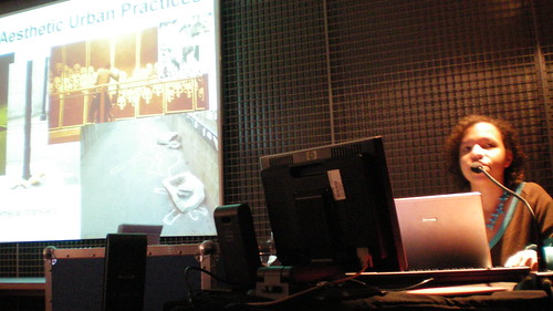
A terceira comunicação foi sobre “Invisible Landscapes” de Liva Dudareva. Ela mostrou alguns projetos já conhecidos como Blast Theory, Yellow Arrow. Perdi um pouco a sua fala já que fui respirar um pouco depois da minha. Pelo que vi no final, o tema foi bem próximo do meu, ressaltando como as mídias locativas reforçam os sentidos dos lugares a partir de novos usos. Ela propõe que as mídias locativas devam servir como ferramentas para arquitetos, urbanistas e designers pensarem o espaço urbano.
Depois, por fim, tivemos a palestra de sueca Lalya Gaye, a realizadora do projeto Sonic City, que também já citei nesse Carnet e nos meus últimos artigos. O tema foi “Locative Audio: Sound and Mobility in Urban Space”. Ela fez uma extensa exposição histórica e mostrou tipologias das mídias locativas. Ela mostrou a convergência entre a arte urbana, a apropriação do espaço, as tecnologias interativas e sons no quotidiano criam novas formas de escrever e perceber a cidade. Ela definiu mídia locativa como “digital media with a sense of place”. Deu vários exemplos de Games (Botfihters and Pirates, Backseat, Can you see me now, ipeg), Annotation (Urban tapestries/Grafedia/Geonotes; GPS position e Social Space (Hummingbirds, jabberwocky, Mobitip, Family Stranger). Depois se concentrou em projetos em locative audio, sudivididos em “collaborative, situated, wearable, mobile phone as a platform”, entre outros. Porjetos: Here&There, Rozier, MIT medialab, 1999; Tactile Sound Garden, Mark Shepard, Buffalo, 2004-06, Sonic City, Gaye, 2002-04, Sound Lens, ImprovE, 2006, CosTune, 2001, Malleable Mobile Music, 2004, Tejp/Audio Tags, Play & FAL, 2003-04, Sonic Graffiti C-Y Lee, 2007, Audio Bombing, Fleming, 2007, Murmur, Location 33, Carter & Lui, USC, 2005, SoundPryer, Interactive Institute, 2001, TunA, Medialab Europe. 2002, Push!Music, 2005, Bass Station, 2003, 34n118w, 7/11 in Goteborg, Key Chain Radio Station, Sakai, 2004, Sound Mapping,1997, Sonic Interface, 1999, Warbike, Toronto, 2005-6, Skatesonic, 2006 entre outros…
No fundo todos mostram o que chamo de “informational territories” e criam “new senses of places”. Nesses projetos podemos ver e ouvir os “informational territories”, perceber como eles mudam o sentido dos lugares, acrescentando sons e histórias. Vemos aqui a produção de sons anexado a lugares, com o que chamei na minha palestra de “post-mass media functions”. Ou seja, como afirma Gaye, locative media é um “creative use of public space”. No final levantou questões sobre controle, privacidade, governos, uso dos espaços, enfim, questões que remetem mais uma vez à idéia de um território informacional em meio a diversas territorialidades que compõem os lugares. É a dinâmica dos lugares que criam os sentidos do espaço.
Saí convencido de que estou no caminho certo.